Image Map Pro for WordPress – Interactive SVG Image Map Builder
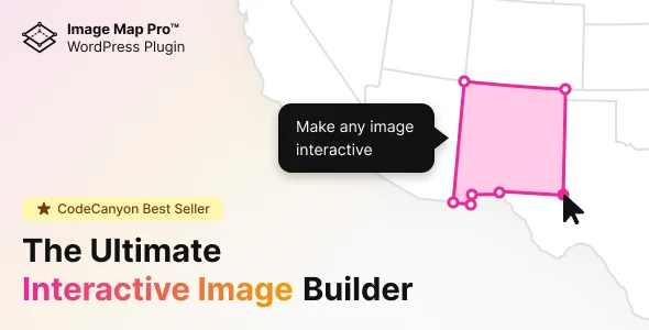
Image Map Pro is a WordPress plugin for building interactive SVG image maps with pins, vector shapes, and tooltips, no coding required.
- Daily automated updates
- VirusTotal 0/70 clean
- Licensed under GPL
- Secure 256-bit checkout
- Instant direct cloud link
What Is Image Map Pro?
Image Map Pro is a JavaScript-and-PHP WordPress plugin, engineered for developers and digital agencies to build interactive SVG image maps over any raster image without hand-writing coordinate geometry. It resolves the core bottleneck of hotspot authoring — traditionally a manual process of calculating polygon coordinates in a code editor — by bundling a dedicated builder web app directly into the WordPress administration environment. In production, the package operates as an authoring and rendering layer: editors draw shapes and configure tooltips in the browser, then the engine emits standards-compliant SVG markup that renders on the public-facing site.
Key Features of the Plugin
The plugin parses a structured map definition authored in its administrative web app and serializes it into vector DOM nodes that the browser paints as scalable SVG. Because the renderer outputs genuine vector paths rather than legacy coordinate maps, geometry survives container resizing and remains sharp on high-resolution displays — a behavior that also lets the output sit inside column-based layouts from container-driven themes such as Bridge without stylesheet scope conflicts.
Architectural Highlights
- Vector Shape Engine: Authors draw polygons, rectangles, and pins over a base photo, floor plan, or illustration. The engine converts each shape into SVG path data, so hotspot boundaries scale proportionally with the image container instead of breaking at responsive breakpoints.
- Bundled Builder Web App: The authoring interface ships inside the plugin as its own web application, handling shape drawing, spot placement, and style configuration entirely client-side before the definition is stored and served by the PHP layer.
- Tooltip and Popup Layer: Each shape or pin binds to a tooltip content region, with popup presentation per the product’s interaction tags (tooltip, popup, spot), letting developers attach contextual annotations to individual hotspots.
- Gutenberg Block Integration: The package is Gutenberg-optimized, meaning finished maps can be inserted through the block editor into posts and pages without pasting raw markup or touching theme template files.
- Per-Shape Style Customization: Fill, stroke, and interaction styling is configurable per shape within the builder, allowing the map’s visual language to match the host theme’s design tokens.
Who Should Use This Plugin?
This codebase targets front-end developers, WordPress engineers, and agencies that need annotation, hotspot, or floor-plan interaction layered onto flat imagery. Typical deployments include product diagrams, campus or facility maps, presentation graphics, and interactive infographics — for instance, an agency building a technology-services site on Inotek can embed an annotated office-location or service-architecture map without commissioning custom JavaScript. The asset is not intended for developers requiring geographic tile-server rendering, real-time geospatial queries, or CRM-bound map data pipelines; its scope is image-based interactivity, and teams needing those larger systems should pair it with dedicated mapping infrastructure rather than expect it from this module.
Compatibility & Runtime Requirements
Baseline runtime constraints center on WordPress core version alignment and browser-level SVG support, summarized below from the official technical attributes.
| Engineering Metric | Deployment Specification |
|---|---|
| Base Technology | WordPress plugin composed of JavaScript (JS), CSS, and PHP files |
| Runtime / Platform Version | WordPress 4.9.x through 7.0.x |
| Browser Compatibility | IE8, IE9, IE10, IE11, Firefox, Safari, Opera, Chrome, Edge |
| Editor Integration | Gutenberg-optimized; block-based insertion |
| Display Output | High-resolution supported; SVG vector rendering |
How to Install & Deploy the Plugin
Deployment follows the standard WordPress plugin lifecycle; once activated, the builder and its administrative modules are fully operational.
- Environment Pre-check: Confirm the target server runs a supported WordPress core version (4.9.x–7.0.x) and that the active theme does not override core SVG rendering behavior on the templates where maps will appear.
- Package Upload: Transfer the plugin archive through the administrative plugin-installation interface, or extract the JS, CSS, and PHP files into the site’s plugins directory via SFTP.
- Direct Activation: Click Activate in the plugins list. This initializes the PHP layer, registers the bundled builder web app within the admin menu, and exposes the Gutenberg block for map insertion.
- Configuration & Testing: Open the builder, author a test map with at least one polygon and one pin, publish it to a staging page, and verify tooltip triggers, shape hit-areas, and responsive scaling before promoting to production.
Frequently Asked Questions
Does building a map require writing JavaScript or SVG code?
No. The bundled builder web app handles shape drawing, pin placement, and style configuration through direct manipulation in the WordPress admin, and the engine generates the underlying SVG output automatically — no coordinate math or hand-authored code is needed.
Are the builder application and the front-end renderer shipped together?
Yes. The package includes both the administrative builder web app and the front-end rendering engine as one codebase, delivered as JavaScript, CSS, and PHP files, so authoring and serving interactive maps require no separate installation.
Will rendered maps stay sharp on retina and high-density displays?
Yes. The plugin is rated for high-resolution output, and because shapes are emitted as SVG vector paths rather than raster overlays, geometry rescales with the container and preserves edge definition on high-pixel-density screens.
Which WordPress versions can the plugin run on?
The plugin supports WordPress cores from 4.9.x up through 7.0.x inclusive, covering both classic-editor installations and modern block-editor environments, with the Gutenberg integration active on builds that ship the block editor.